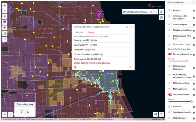
CHICAGO, June 22, 2021 /PRNewswire/ — BuildCentral today announced Geospex™, a new planned construction visualization tool built for real estate, finance and construction industry professionals.
Geospex™ provides a new way for construction industry, finance and real estate professionals to better evaluate their key markets for growth opportunities and potential risks.
Using ESRI geospatial technology, Geospex™ pairs planned real estate development data from BuildCentral with intelligent data layers to deliver comprehensive market-specific insights — all without having to comb through multiple tools and tabs. Intelligent data layers include parcel ownership data, nearby opportunity zones, U.S. Census data, MSA and zip code boundaries, real-time weather warnings, demographics, drive times and more.
“Geospex is the future of real estate market research,” says Damian Eastman, CEO at BuildCentral. “Whether you’re a builder, in finance, an industry supplier, or in real estate, you want to know where all the future commercial and residential developments are planned, when they’re coming and who’s responsible. With Geospex, you can visualize these future developments and stakeholders all plotted on a dynamic, interactive map for any U.S. zip code.”
He adds, “Then, if you want to dig deeper, you can add more context using our library of intelligent data layers. Maybe you’d also like to see all the…


