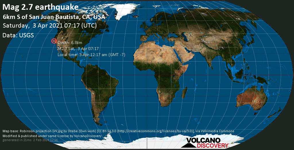
Weak magnitude 2.7 earthquake at 7 km depth
3 Apr 07:19 UTC: First to report: USGS after 2 minutes.
I felt this quake
I didn’t feel it
Date & time: 3 Apr 2021 07:17:26 UTC –
Local time at epicenter: Saturday, 3 Apr 2021 12:17 am (GMT -7)
Magnitude: 2.7
Depth: 6.8 km
Epicenter latitude / longitude: 36.796°N / 121.53083°W ![]() (San Benito, California, United States)
(San Benito, California, United States)
Nearest volcano: Mammoth Mountain (240 km / 149 mi)
Nearby towns and cities:
6 km (3 mi) S of San Juan Bautista (pop: 1,960) –> See nearby quakes!
13 km (8 mi) E of Prunedale (pop: 17,600) –> See nearby quakes!
13 km (8 mi) WSW of Hollister (pop: 37,500) –> See nearby quakes!
17 km (11 mi) NE of Salinas (pop: 157,400) –> See nearby quakes!
24 km (15 mi) S of Gilroy (pop: 53,200) –> See nearby quakes!
24 km (15 mi) ESE of Watsonville (pop: 53,600) –> See nearby quakes!
27 km (17 mi) ENE of Marina (pop: 21,200) –> See nearby quakes!
39 km (24 mi) SSE of Morgan Hill (pop: 42,900) –> See nearby quakes!
69 km (43 mi) SSE of San Jose (pop: 1,026,900) –> See nearby quakes!
199 km (123 mi) S of Sacramento (pop: 490,700) –> See nearby quakes!
Scattered Clouds
 8.9°C (48 F), humidity: 87%, wind: 3 m/s (5 kts) from SW
Primary data source: USGS (United States Geological Survey)
Estimated released energy: 7.1 x 10⁸ joules (197 kilowatt hours, equivalent to 0.169 tons of TNT) More info
[show map]
[smaller] [bigger]


