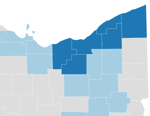
CLEVELAND, Ohio – Cleveland’s metro area now officially includes Ashtabula County.
The federal government in July updated the nation’s metropolitan statistical areas and the larger combined statistical areas for several regions, including some changes for Northeast Ohio.
These areas are used to report statistics from many government agencies, including the Census Bureau and the Bureau of Labor Statistics, and are often referenced in everyday speak.
Cleveland’s new metro area adds Ashtabula to the five counties that have long been classified as Cleveland metro: Cuyahoga, Lorain, Medina, Geauga and Lake. In comparison, Columbus metro covers 10 counties and Cincinnati has 15, including some in Indiana and Kentucky.
“I look at these as just overdue recognition,” says Baiju Shah, president of Greater Cleveland Partnership, referencing both the changes in the metro area and the larger region.
MSAs typically have one urban area of 50,000 or more (Cleveland has more than 300,000 residents) plus adjacent territory with a high degree of integration measured by commuting ties. Some metro areas have multiple urban areas or principal cities. Until this year, Cleveland’s second principal city was Elyria, but that is no longer listed as the case.
While another county has been added geographically, the change has little impact on the metro area’s population. Ashtabula, with 97,014 residents, ups the metro area’s population to 2,160,146, using the latest Census Bureau estimates…


